What Does Namsan Mean In Korean?
Namsan means South Mountain in Korean, and the name explains exactly where the hill sits in old Seoul. Here is what the name covers, how tall it is, and what it means for a visit.
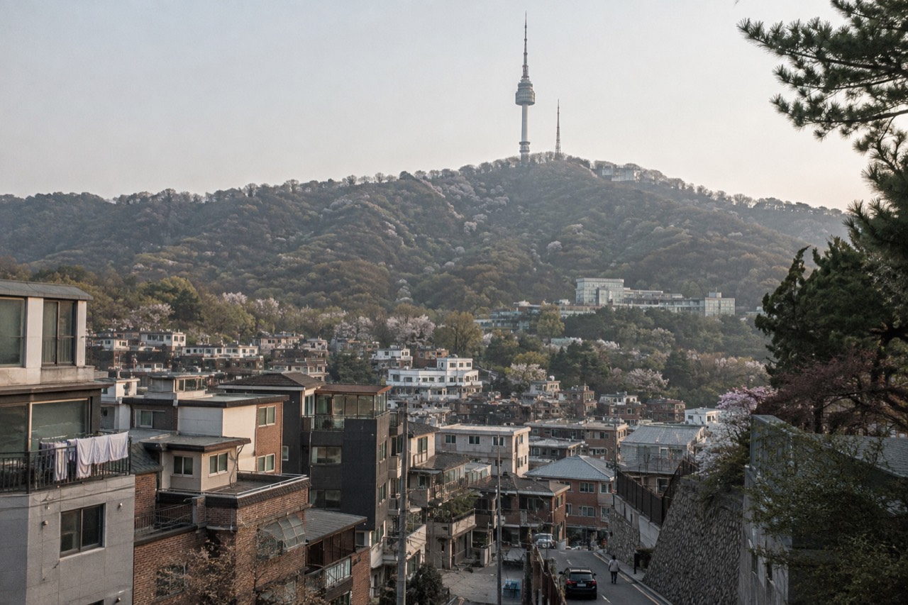
Ask a Korean speaker what Namsan means and the answer takes about two seconds: it means South Mountain. The name is that literal, and that literalness is the interesting part, because it tells you the hill was named from somewhere else, by people standing somewhere else, looking south. This page unpacks the name, what it covers on a modern map of Seoul, and why a hill of this size ended up with the city's most famous tower standing on top of it.
What Does Namsan Mean In Korean?
In Korean, Namsan is written 남산 and it means South Mountain. The syllable nam (남) means south, the syllable san (산) means mountain, and Korean stacks the two together the way English stacks the words in place names like North Sea or South Downs. The name is not poetic or ceremonial, it is a direction plus a feature, and it has stuck to this one hill in central Seoul for centuries.
That plainness is worth pausing on. Many of the world's famous hills carry names borrowed from mythology, royalty or religion. Namsan does none of that. It says what it is and where it is, and the "where" only makes sense once you know what it is south of. The reference point is the old walled city of Seoul, the capital the Joseon dynasty established at the end of the 14th century. Within those walls, the mountain that stood to the south was, simply, the southern mountain.
Korean place names work this way all the time, and once you notice the pattern you start reading the city's geography in its vocabulary. San appears everywhere there is a hill: Bukhansan to the north of the city, Namsan at its centre-south. The syllable carries no mystique for a local, which is exactly why the name has survived so many changes of government, dynasty and street grid around it.
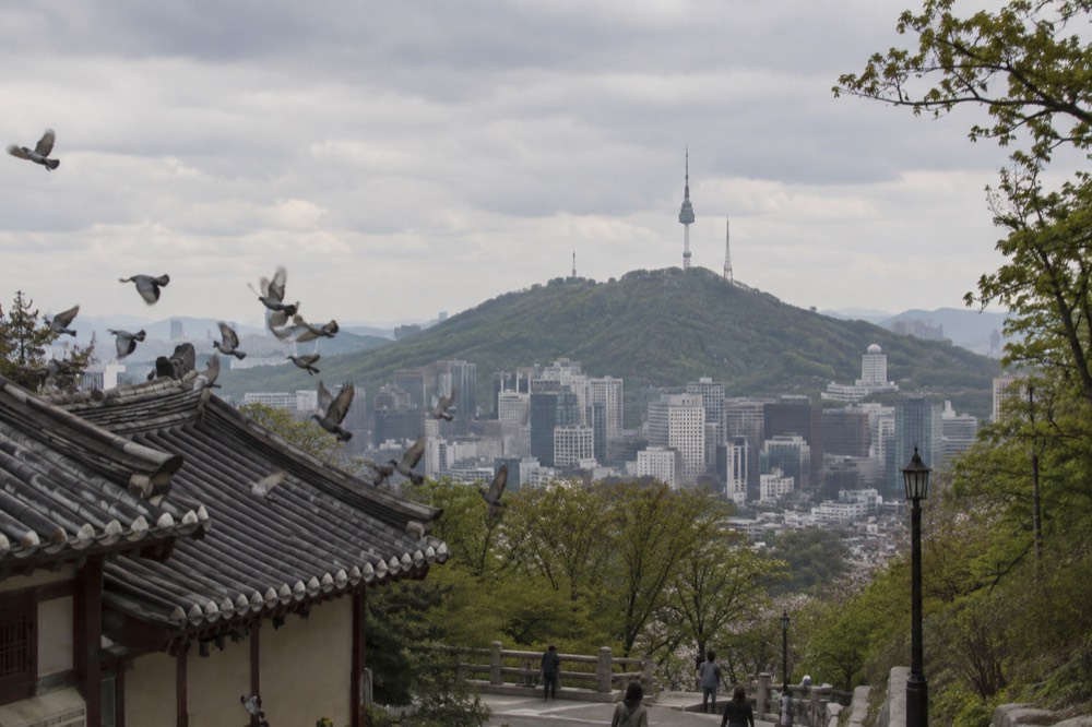
For a visitor, the practical payoff of decoding the name is orientation. Namsan sits immediately south of the historic core, which means the districts a tourist actually walks, Myeongdong on one flank, the palaces and Gwanghwamun a little further north, are all arranged around this one hill. Seoul's own city government feature on the mountain groups the trails, the love locks and the summit views together as one destination, and the name Namsan is the umbrella over all of it.
If you are planning to go up rather than just read about it, the bookable product on the mountain is the observatory ticket, and there are a few ways to buy it.
Where does the name South Mountain come from?
The name comes from the mountain's position relative to old Seoul's inner city, the capital area laid out inside the Seoul City Wall at the end of the 14th century. To the people living inside that wall, this hill was the mountain to the south, and the direction became the name. The wall still stands in parts today, and one verified trail section runs across Namsan itself, from Sungnyemun to Jangchung Gymnasium.
The Seoul City Wall, listed as Historic Site No. 10, is the key to the whole naming logic. When the Joseon dynasty founded its capital here, it enclosed the city with a wall that rode over the surrounding hills, and Namsan was one of those hills, sitting inside and astride the southern stretch. A walker on Namsan today can still follow a surviving section of that wall path, and the city promotes it as part of the mountain's free offer. The name Namsan predates every building on the summit, including the tower, by centuries.
What the name does not tell you is anything about size, ownership or fame. It is a 270.0 m hill, or 885 ft, measured to the point where the tower is built, according to the tower operator's own specification pages. That is a genuinely modest height for a mountain, and Koreans use the word san for everything from small wooded hills like this one to major peaks, so the name makes no promise about altitude. The fame came later, and it came from the tower.
The mountain's history as a signal station reinforces how old its role in the city is. Below the tower sits Namsan Bongsudae, a restored Joseon-era beacon mound at Palgak Square, designated Seoul Monument No. 14, where smoke and fire signals once carried news across the country. The mountain was infrastructure before it was a viewpoint, and the name Namsan was already old when the beacons were lit.
If the name has made you want to stand on the summit and look back at the city that named it, the deck ticket is the one paid item on the mountain.
Is Namsan the same place as N Seoul Tower?
Yes, in everyday usage they refer to the same summit, but they are different things. Namsan is the mountain, a public park owned by the city of Seoul. N Seoul Tower is the broadcast and observatory tower standing on top of it, opened to the public in October 1980 and renamed N Seoul Tower in December 2005 after a full renovation. The tower is 236.7 m tall as a structure.
The distinction matters for one practical reason: what is free and what is not. Namsan Park, the summit plaza, the terraces around the tower base, the Palgakjeong pavilion area, the love locks, the beacon mound and the City Wall path are all free and need no ticket. The only thing on the mountain that is ticketed is the observation deck inside the tower itself. A visitor can reach the summit, walk the whole plaza and enjoy the view from the base without paying anything beyond transport, a fact Seoul's official tourism site states plainly: the entrance to Namsan Park is free.
The tower's total elevation figure is where the two names get tangled. The operator gives 506.7 m, or 1,662 ft, above sea level for the top, which is the mountain plus the structure combined. The mountain alone is 270.0 m and the tower structure alone is 236.7 m, made up of a 135.7 m body and a 101 m steel mast. A separate figure of 479 m circulates from the cable car company's marketing and should not be read as the tower's height.
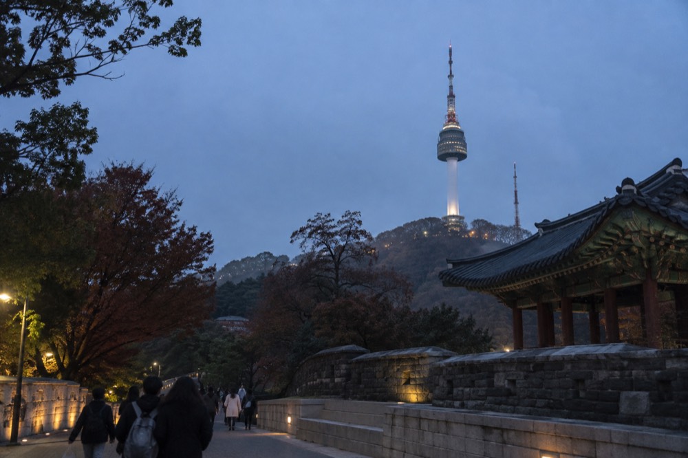
The renaming in December 2005 is worth a sentence because it explains the "N". After the YTN-CJ renovation contract of April 2005 and a full renovation running April to November that year, the tower relaunched under the name N Seoul Tower, and it has carried that name since. Older guidebooks and plenty of signage still say Seoul Tower, and both names point at the same building, on the same mountain, answering to the old name Namsan.
For readers who want the paid experience as well as the free one, the deck ticket covers the observation levels inside the tower.
What does the name Namsan cover on a map today?
Administratively, Namsan is Namsan Park, which Seoul's official tourism site describes as the largest civic park in Seoul, divided into four districts: Jangchung, Yejang, Hoehyeon and Hannam. The name covers the whole mountain, every trail on it, the summit plaza and the free facilities around the tower base, not just the tower itself.
That is a bigger footprint than most visitors expect. The four districts ring the hill, and the entrances a traveller is likely to use sit in different ones: the Myeongdong and Hoehyeon side toward the cable car, the Jangchung side near the National Theater of Korea, and so on. Seoul's tourism portal lists the park's four districts and its free entry on the same page, which is the cleanest single source for what the name encloses.
| Part of Namsan | What it is | Ticket needed |
|---|---|---|
| Namsan Park trails and districts | The mountain's public parkland across Jangchung, Yejang, Hoehyeon and Hannam | No |
| Summit plaza and terraces | The open ground and viewing terraces around the tower base | No |
| Palgakjeong and the beacon mound | The pavilion area and the restored Joseon signal station, Seoul Monument No. 14 | No |
| Love locks and City Wall path | The lock deck and the surviving wall trail from Sungnyemun to Jangchung Gymnasium | No |
| Observation deck inside N Seoul Tower | The indoor deck at the top of the tower, reached from Plaza 5F or Tower 1F | Yes |
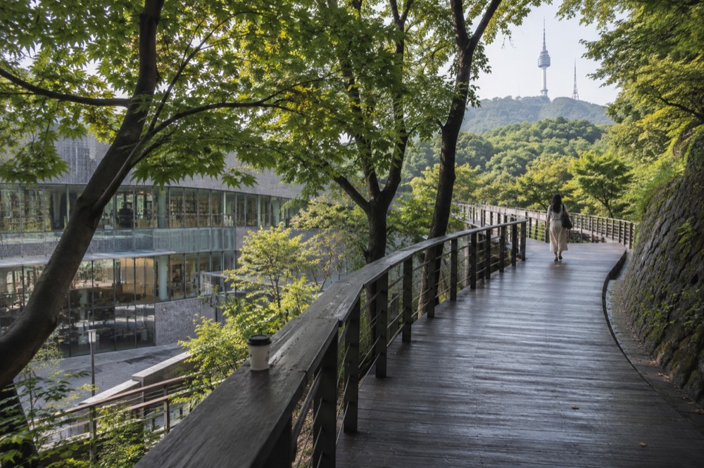
The name also covers newer things that older maps do not show. In October 2025 the city opened the Namsan Sky Forest Trail, a barrier-free timber deck path linking the Huam-dong Namsan Fitness Center to the Namsan Library, built so wheelchair users and older visitors can get up the mountain on the gentlest possible line. Named stops along it include the Sunset Observatory, the Wind View Bridge, a Pine Rest Area and Sowol Garden at the library entrance. The same works closed the unofficial side paths that had been worn into the hillside and restored them, so walkers are now directed onto the official trails only.
From September 2026 the name covers one more thing no printed guide knows about: a free guided night walk run by the city itself, over the summit, past the tower and the love lock deck, finishing at Palgakjeong, with departures at 18:00 and 20:00 every day. It is part of Seoul's official walking-tour programme and it is described on the city's own media hub. For anyone working out how to spend an evening on the mountain, our guide to N Seoul Tower after dark covers the rest of the picture.
If you would rather ride than climb, the combo option pairs the deck ticket with the cable car, with one catch worth knowing before you buy.
How tall is Namsan, really?
Namsan rises 270.0 m, or 885 ft, to the point where the tower is built, and the tower structure adds another 236.7 m, giving a total elevation of 506.7 m, or 1,662 ft, above sea level at the top. By mountain standards the hill is small; by city-hill standards it dominates its surroundings completely, because central Seoul around it is almost flat.
The numbers come from the tower operator's own specification pages, and they are worth keeping straight because two wrong figures circulate widely. One is the 479 m arrival-altitude number used in the cable car company's own marketing, which is not the tower's height and should not be quoted as one. The other is a confusion between the tower's structure and its elevation above sea level, which are different measurements: 236.7 m of steel and concrete, standing on a 270.0 m hill.
| Measurement | Figure | What it measures |
|---|---|---|
| Namsan | 270.0 m / 885 ft | The mountain, to the point where the tower is built |
| Tower structure | 236.7 m / 777 ft | The tower body plus its steel mast |
| Total elevation | 506.7 m / 1,662 ft | The top of the tower above sea level |
| Clear-day visibility | up to 50 km | What the operator says can be seen from the deck |
That 50 km visibility claim is the operator's own, and it names real landmarks in each direction: Achasan and Ttukseom to the east, Yanghwa Bridge, Nanjido and Ilsan to the west, Gwanaksan and the Seoul Arts Center to the south, and Bukhansan and Cheonggyecheon to the north. On a hazy day the honest expectation is much less, and no official source promises otherwise.
The modest height has a practical consequence that surprises first-time visitors: you cannot drive up. General vehicle access to Namsan has been restricted since 1 May 2005 for ecological protection, with further restrictions on tour buses since August 2021. The ways up are the cable car, the free Namsan Ormi inclined elevator, the circular buses 01A and 01B, or your own feet, and our page on getting to N Seoul Tower lays out each route with the verified fares and hours.
Does the old name still matter for a visit?
It matters more than you would expect, because almost everything enjoyable on Namsan is free and sits outside the one ticketed attraction, and knowing the difference between the mountain and the tower is the difference between a paid visit and a free one. The name Namsan is your reminder that the park, the trails, the plaza and the views from the base all belong to the city, not to the ticket booth.
Consider the economics from the visitor's side. The paid list on this mountain is short: the observation deck ticket, the cable car if you ride it, the circular bus fare if you take it, parking, and food and shopping. Everything else, and it is a long list, costs nothing: the park and its trails, the summit plaza and terraces, Palgakjeong, the love locks, the beacon mound, the City Wall path, the Seoul Tower Plaza shops and cafes, the Ormi elevator and the cable car company's Myeongdong shuttle bus. Our longer treatment of what is free on Namsan walks through the boundary in detail.
The name also carries the mountain's newer identity. Since the film KPop Demon Hunters put N Seoul Tower on screen in June 2025, international attention on the summit has grown, and Seoul's mayor publicly tied the mountain's rising profile to the film while inspecting its new access trails. The city responded by building exactly the kind of infrastructure the old name implies: public, civic, open to everyone, from the barrier-free Sky Forest Trail to the free guided night walk launched in September 2026.
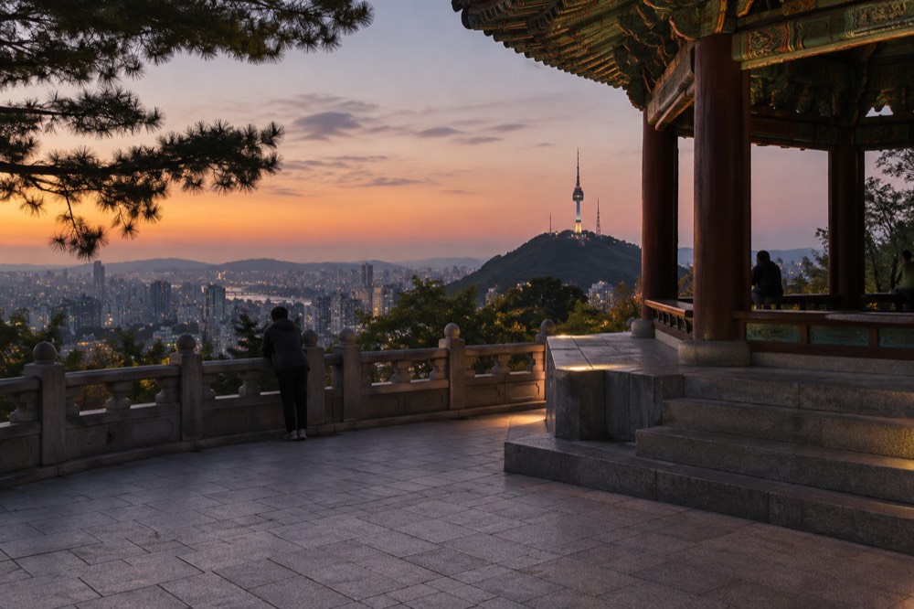
So when a local says Namsan, they may mean the park, the hill, the summit, the night-view spot or the whole district-flanked green heart of the city, and they will rarely mean the tower specifically. When a visitor says it, they usually mean the tower. Both are correct, and the mountain, which is the older name by centuries, generously covers both meanings. Namsan Tower Seoul exists as a site precisely to keep those two meanings untangled.
Whether you go up for the free plaza or the paid deck, the choice of ticket comes down to how you want to arrive and how much of the tower you want to see.
Common questions about the meaning of Namsan
What Does Namsan Mean In Korean?
Namsan means South Mountain. Nam (남) is the Korean word for south and san (산) is the word for mountain, so the name simply states the hill's position relative to old Seoul's walled inner city. It is a directional, descriptive name rather than a ceremonial one, and it has been in use for centuries.
Is Namsan the same thing as N Seoul Tower?
No. Namsan is the mountain, a public park owned by the city of Seoul. N Seoul Tower is the broadcast and observatory tower standing on its summit, opened to the public in October 1980 and given its current name in December 2005. Everyday speech often blends the two, but only the observation deck inside the tower requires a ticket.
How tall is Namsan?
The mountain rises 270.0 m, or 885 ft, to the point where the tower is built. The tower structure adds 236.7 m, giving a total elevation of 506.7 m, or 1,662 ft, above sea level at the top. All three figures come from the tower operator's own specification pages.
Is Namsan Park free to enter?
Yes. Seoul's official tourism site states directly that the entrance to Namsan Park is free. The park and its trails, the summit plaza, the terraces, Palgakjeong, the love locks, the beacon mound, the City Wall path and the plaza shops and cafes all cost nothing. The paid items are the observatory deck ticket, the cable car if you ride it, the circular bus fare, parking, and food and shopping.
Can you walk up Namsan?
Yes, and the city has made it easier recently. The Namsan Sky Forest Trail, opened in October 2025, is a barrier-free timber deck path linking the Huam-dong Namsan Fitness Center to the Namsan Library, with stops including the Sunset Observatory and Sowol Garden. Older walking routes, including the Sam-soon Steps, also remain in use, and unofficial side paths have been closed and restored.
Why is the tower called N Seoul Tower?
The tower was renamed N Seoul Tower in December 2005, after a renovation running from April to November of that year under a YTN-CJ contract. Before that it was known simply as Seoul Tower, and both names still appear on signage and in guidebooks. The building itself opened to the public in October 1980.