How Long Does It Take To Walk Down From The Seoul Tower?
The quickest ways down from N Seoul Tower and why walking downhill is the smarter way to leave Namsan. Times, route maps, and what you see along the way.
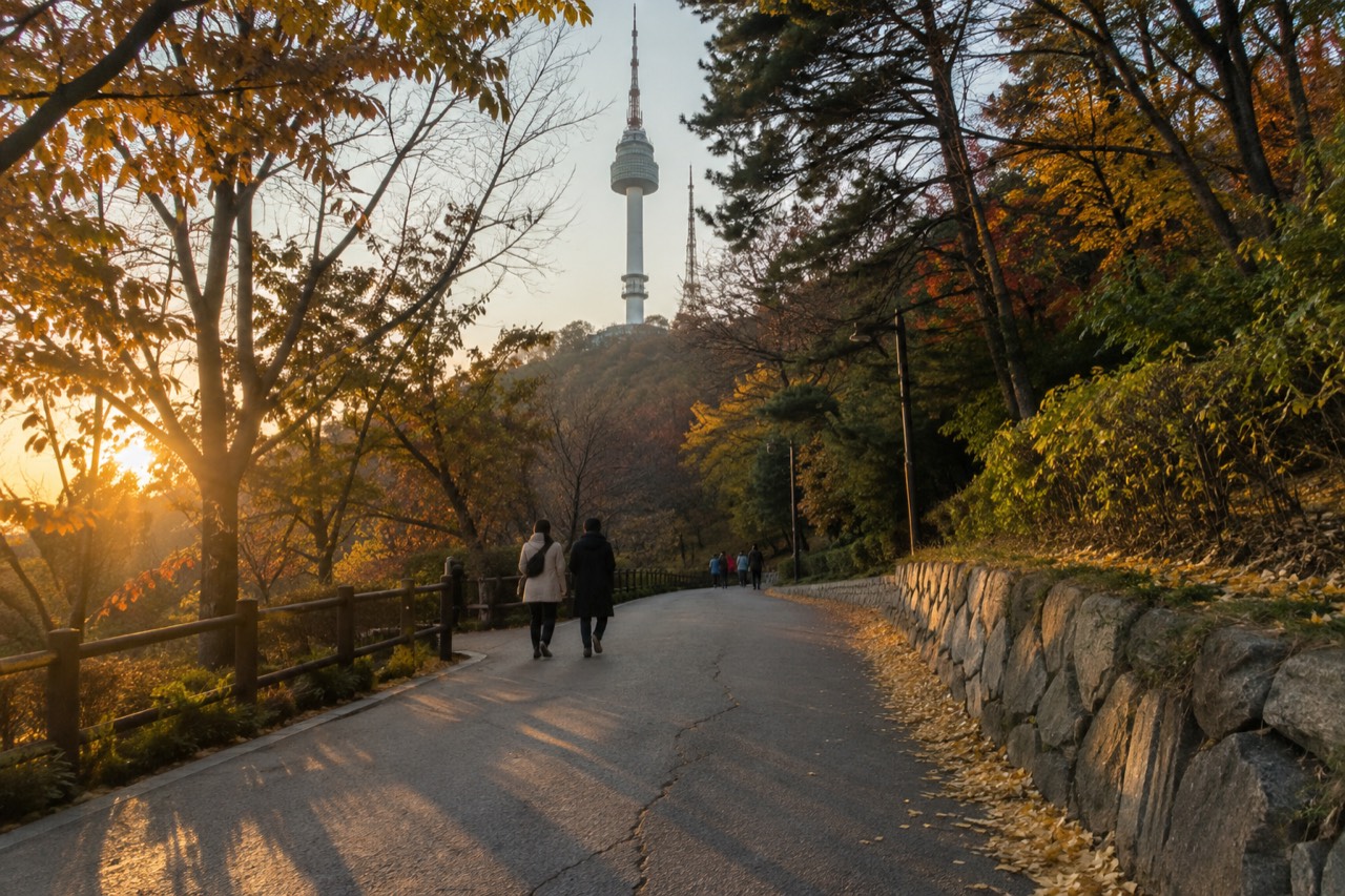
How Long Does It Take To Walk Down From The Seoul Tower?
You have ridden the cable car up, taken in the panorama from the observation deck, and now you are looking at the mountain beneath your feet. Walking down from N Seoul Tower is a genuine visitor shortcut: it cuts the cost of the return journey, ends in the neighbourhood you want to be in, and turns the descent into a free stroll through one of Seoul’s largest city parks. The question that follows every observatory visit is the same, and it comes with a practical answer.
How Long Does It Take To Walk Down From The Seoul Tower?
It takes between 30 and 40 minutes, depending on which of the three signed trails you follow. The Sam‑soon Steps lead down to the area beside the Seoul Education Research and Information Institute, the Namsan Public Library path delivers you to the library’s southern circuit entrance, and the National Theater steps finish at the theatre’s ticket booth. All three are downhill, well‑maintained, and clearly marked.
The times come directly from the tower’s own visitor information, and they assume a steady walking pace without long stops. Because the descent is gentle on the knees and entirely shaded by the Namsan forest canopy, most people complete it faster than the signposted figures suggest. You are never far from a bench, a viewpoint, or a set of stairs that bypasses a longer switchback. The path you choose depends on where in Seoul you want to land, and every route drops you within a short walk of a subway station or a bus stop.
What makes the walk down practical for an observatory visitor is that it works with every way of getting up. If you took the cable car, you can ride one way and walk down. If you came up on the Namsan circular bus, the descent still saves a bus fare and a wait. Even the Namsan Ormi inclined elevator, which is free and runs between the tunnel‑3 entrance and the cable car station, can be part of a one‑way plan: walk down and you bypass the return climb.
The ticket you bought to reach the deck inside Namsan Tower Seoul does not cover the return transport because the observatory admission is the only paid part of the visit. Everything around the tower base, the summit plaza, the love‑lock terraces, and every one of the forest trails is free and open to the public. Walking down costs nothing, and it turns the journey off the mountain into part of the experience rather than a line at a bus stop.
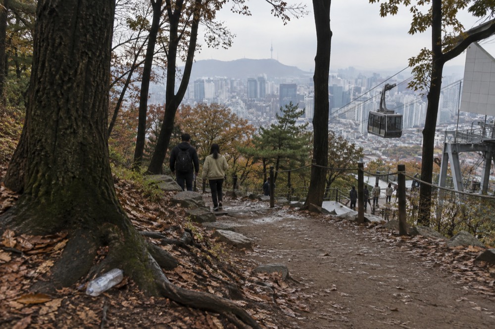
Which Route Is Fastest Down From N Seoul Tower?
The National Theater steps take 30 minutes uphill from the theatre ticket booth to the summit, per the tower owner's trail times; no separate descent time is published. The Namsan Public Library path also takes 30 minutes, while the Sam‑soon Steps need 40 minutes because they follow a longer run of staircases and gently graded switchbacks. None of the three official trails is difficult, and all three end within a ten‑minute walk of a major transport link.
Each route is useful for a different post‑visit plan. The Sam‑soon Steps drop you nearest to Myeongdong, so if you want to eat or shop straight after the walk, that is the obvious choice. The library path puts you close to the southern edge of the mountain with quick access to the Hoehyeon‑dong neighbourhood. The National Theater route finishes beside the theatre complex and a short walk from Dongguk University Station, which connects directly to Line 3.
| Trail | Time down | Finish point | Nearest transport |
|---|---|---|---|
| Sam‑soon Steps | 40 minutes | Seoul Education Research and Information Institute | Myeongdong Station (Line 4) |
| Namsan Public Library | 30 minutes | Southern circuit entrance by the library | Hoehyeon Station (Line 4) or shuttle bus stop |
| National Theater steps | 30 minutes | National Theater of Korea ticket booth | Dongguk University Station (Line 3) |
The signposted times are identical in both directions on the official boards, but anyone who has walked Namsan in the summer humidity knows the reality is lopsided: the downhill journey takes less effort and feels shorter than the numbers suggest. You can stop at the Bongsudae beacon mound, the Seoul City Wall markers, or one of the viewing platforms that face the Han River without adding more than a few minutes to the total.
Two other paths are worth knowing about, though neither is signposted as a primary trail. The new Namsan Sky Forest Trail, a barrier‑free timber deck path opened by the Seoul Metropolitan Government in October 2025, links the Huam‑dong fitness centre to the Namsan Library and is fully wheelchair‑accessible. It runs through the Sunset Observatory, the Wind View Bridge, and a Wellness Garden, and it works equally well in the other direction, but it is a longer, meandering route and no official time has been published for it. The city’s media channel describes its named stops, and the trail runs from the library end of the hill down toward Huam-dong, and no official walking time is published for it. Check the city’s own walking‑tour page for the current state of the trail if you plan to use it.
Two recent changes matter to anyone walking down. First, the city has closed the unofficial side paths that used to criss‑cross the slope and restored them ecologically. You are now directed onto the signed trails only, so you cannot freestyle a shortcut through the forest. Second, from September 2026 Seoul runs a free guided night walk over the summit itself, with departures at 18:00 and 20:00, and the route passes the love locks and finishes at Palgakjeong. The walk is booked through the city’s own tourism site. If you time your observatory visit to coincide with it, you can join a licensed guide for the upper part of the walk and then walk down afterwards on your own.
The best descent route is the one that finishes closest to your dinner reservation. If you do not have one yet, head for the Sam‑soon Steps and the Myeongdong side: the area around the station is packed with Korean street‑food stalls and restaurants that stay open late, and you will be walking straight into the most convenient part of central Seoul for a post‑walk meal.
Why Walking Down Is Better Than Walking Up
Walking down from N Seoul Tower is faster, cooler, and ends exactly where you want to be. The ascent by foot is steep, unshaded in parts, and takes most visitors longer than they expect, whereas the downhill puts gravity on your side and delivers you to a subway station without a sweat. It also lets you combine a ticketed observatory entry with a free walk through one of Seoul’s largest civic parks.
The cable car and the circular shuttle bus already solve the problem of getting up the mountain, and they are the obvious choice for visitors who want to save their legs for the view. Riding one way and walking the other is cheaper than a round‑trip cable car fare and more flexible than waiting for a bus that runs every 9 to 14 minutes. The cable car company itself runs a free shuttle between Myeongdong Station and its lower platform, departing from noon to20:30, so the logic works in either direction: ride up, walk down, and your return journey costs nothing.
The physical difference is significant. The Namsan trails gain roughly 200‑250 metres of elevation from the base to the summit. Walking up the Sam‑soon Steps can leave a casual visitor breathless, especially in July and August. Walking down the same steps is a stroll. The Seoul Metropolitan Government’s own walking directions note that the path from Myeongdong Station Exit4 to the cable car station via the Namsan Ormi is only590 metres and about12 minutes, but the walk from the station to the summit on foot is far longer and the city does not publish a time for it because it is not a standard route. The descent, by contrast, is well documented and universally recommended.
One practical point most visitors overlook is the weather. N Seoul Tower sits more than500 metres above sea level, and the wind up there can be fierce even on a mild day. Once you drop into the trees on the way down, the wind disappears and the temperature feels several degrees warmer. In winter, that means the walk down is more comfortable than standing on the exposed observation deck. In summer, the forest canopy shades the path from mid‑morning until late afternoon, and the downhill breeze makes the temperature manageable.
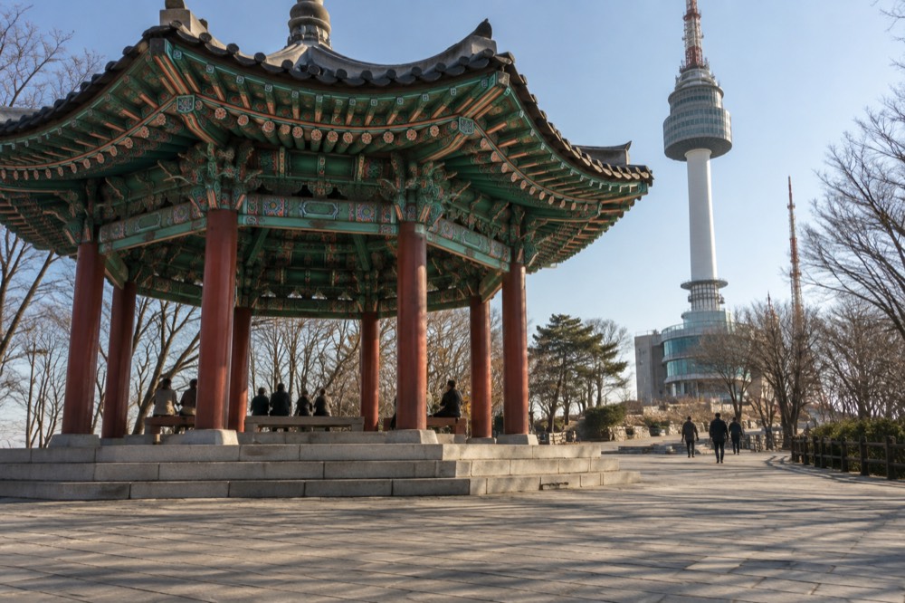
The Sam‑soon Steps and Other Named Trails
The Sam‑soon Steps are the best‑known downhill route, named after the K‑drama “My Lovely Sam‑soon.” They begin beside the Seoul Education Research and Information Institute and climb‑or descend‑through a long staircase flanked by forest, ending at Palgakjeong and the tower plaza. The other two official trails, the Namsan Public Library path and the National Theater steps, are less crowded and offer wider views of the city.
Each trail has a character. The Sam‑soon Steps are the cinematic route, and they are the one most visitors already recognise from the drama’s poster shots. The staircase is well‑kept, the handrails are solid, and the slope is broken by flat landings where you can stop and look back at the tower looming above the treeline. The bottom of the steps sits a short walk from the Hoehyeon‑dong neighbourhood, where you can pick up a coffee and a hotteok before heading to Myeongdong.
The Namsan Public Library path is the quietest of the three. It starts on the southern side of the summit near the library building and follows a broad, paved forest road that sees more joggers than tourists. The surface is smooth enough for a stroller, and the views open out onto the Yongsan‑gu side of the city. If you want to walk down without the selfie‑stick crowd, this is the one to pick. At the bottom, you can catch the Namsan circular bus from the library stop or walk ten minutes to Hoehyeon Station.
The National Theater steps are the quickest because they are almost entirely stairs. The route cuts straight down the eastern slope past the theatre complex and the gentle slope of the southern circuit road. The steps are steeper than the Sam‑soon Steps in a couple of places, but the total time is the shortest, and the finish point is directly outside the theatre ticket booth, where you can often hear rehearsals drifting out of the open doors.
The Namsan Park walk‑up guide covers each of these trails in the uphill direction, but the downhill experience is different enough that it deserves its own plan. Uphill, you are watching your breathing. Downhill, you are watching the city unfold beneath you, and you have the time to notice the details: the grey stone of the Seoul City Wall peeking through the undergrowth, the beacon mound’s restored signal station, the couples stopping to add a padlock to the terrace railing. The love‑lock decks are at the summit, so you pass them before you start the descent, but the ritual is part of the same walk, and plenty of visitors buy a lock, hang it, and then walk down.
What You’ll See on the Way Down
Every downhill route passes a curated slice of Namsan Park that most cable‑car riders miss entirely. The Seoul City Wall, a Joseon‑era beacon mound, a poetry monument, and several free viewing platforms are spaced along the three main trails, and they are all open to the public without a ticket.
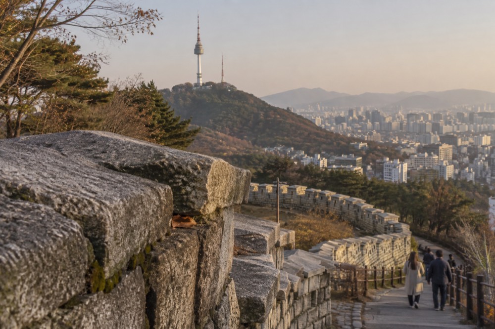
The Namsan beacon mound, Bongsudae, sits just below the tower plaza and is a restored signal station that once relayed messages from the northern border to the king. The explanatory plaques are in English and Korean, and the view from the platform there is one of the best on the mountain because it faces the Han River without the tower’s own structure in the way. A few hundred metres further down, sections of the Seoul City Wall emerge from the slope. The wall is a designated Historic Site and stretches from Sungnyemun to Jangchung Gymnasium, and the walk‑down routes follow parts of it. You can run your hand along stones that date to the fourteenth century while the traffic of modern Seoul hums below.
Near the library path, the Kim Sowol poetry monument marks the entrance to the Sky Forest Trail. Sowol’s most famous poem, “Azaleas,” is engraved on a stone beside a small garden, and the city has built a quiet seating area around it. In spring, the trail from the library to the tower is lined with cherry trees, and the Seoul Metropolitan Government specifically names that stretch as a blossom route. The long‑term average for Seoul’s cherry flowering is around8 April, measured at the official KMA observation tree in Jongno, but Namsan’s own trees can open a few days earlier or later depending on the year.
At the bottom of every route you find the same thing: a working Seoul neighbourhood. The Myeongdong side, reached via the Sam‑soon Steps, dumps you into a district that stays awake later than almost anywhere else in the city. The Hoehyeon side gives you the underground shopping centre and the Line4 station. The National Theater side is quieter, but Dongguk University Station is directly there, and a ten‑minute bus ride takes you to the Dongdaemun Design Plaza. The point is that walking down from N Seoul Tower is never a dead end. It is a connector.
Combining the Walk Down With an Observatory Ticket
The observatory ticket and the descent are independent choices, and they work best when you buy the ticket you want and walk down afterwards. The observation deck admission is the only paid part of the mountain; everything else is free, including the summit plaza and all the walking trails.
The simplest plan is to book the observatory ticket in advance, ride the cable car or the bus up, spend as long as you like on the deck, and then walk down. Because the deck stays open until 22:30 on weekdays and 23:00 at weekends, with last admission30 minutes earlier, you can time a late‑afternoon entry, watch the city lights come on, and still have plenty of time for a dusk descent. The cable car company itself recommends the sunset‑to‑night‑view window for a ride up, and the downhill walk fits perfectly after that.
If you have already bought a combined ticket that includes the cable car, you can still walk down. The cable car fare is for a one‑way or round‑trip ride, and the ticket does not force you to use both directions. The walk down simply replaces the return ride, and you will not be alone: on any clear evening, a steady stream of visitors leaves the summit on foot, following the lit paths and the glow of the city below.
A group that wants to split the experience can do it easily. One person rides the cable car both ways while the rest of the group walks down, and they meet at the Myeongdong shuttle‑bus stop or a named cafe at the bottom. The paths are safe, well‑lit after dark, and busy enough that a solo walker does not feel isolated. The city’s new night‑tour programme, which runs through the summit from September2026, adds a scheduled group presence to the top of the mountain after sunset, so the area is even livelier than it was a year ago.
The view from the deck is what most visitors come for, and the operator’s own figure of up to50 km on a clear day is not an exaggeration: Achasan and Ttukseom to the east, the Han River bridges, Bukhansan to the north, and the whole sweep of Gwanaksan to the south are visible with the naked eye. The digital telescopes on the roof terrace and the observation floors zoom to36x, which is enough to read the name on a riverboat. The descent afterwards does not compete with that experience; it extends it. You start at the highest point and walk the city down layer by layer.
Common questions about walking down from the Seoul Tower
How Long Does It Take To Walk Down From The Seoul Tower?
Between30 and40 minutes, depending on the trail. The National Theater steps and the Namsan Public Library path each take30 minutes, while the Sam‑soon Steps take40 minutes.
Is it safe to walk down at night?
Yes. The main trails are lit after dark, and the summit area is busy well into the evening. The new city‑run night walking tour adds a scheduled group presence from September2026, and the paths are wide enough to feel secure even for a solo walker.
Do I need a ticket to walk down?
No. Namsan Park and its trails are free and open to the public. The only paid part of the mountain is the observatory deck inside the tower. Once you leave the deck, you can walk anywhere on the summit or the slopes without a ticket.
Can I walk down if I rode the cable car up?
Yes. The cable car ticket can be used one way, and many visitors ride up and walk down to save the return fare. The cable car company’s free shuttle bus from the lower station to Myeongdong runs from noon to20:30, so that option is available if you change your mind.
Which trail is best for families with children?
The Namsan Public Library path is the gentlest for small children because it is a broad, paved road with minimal stairs, and it ends near a public library that has restrooms and seating. The Sam‑soon Steps are doable but involve many stairs, so they suit older children who can manage the steps comfortably.
What should I wear for the walk down?
Comfortable walking shoes are enough; the paths are paved and well‑maintained. In summer, bring water, as there are no drinking fountains on the trails. In winter, the summit wind can be cold, but once you are in the trees the temperature rises, so layers work well.